Introduction:
“At
nightfall rocks and shoals were seen ahead… at supper she (HMB
Endeavour) went over a bank of 7 or 8 fathom water which she came
upon very suddenly: this we concluded to be the tail of the Shoals
we had seen at sunset and therefore went to bed in perfect security,
but scarce were we warm in our beds when we were called up with
the alarming news of the ship being fast ashore upon a rock, which
she in a few moments convinced us of by beating very violently against
the rocks.” Joseph Banks, HMB Endeavour, 11 June, 1770.
 |
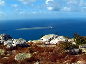
The
Endeavour had just struck the Great Barrier Reef, which Captain
Cook did not know existed. He was quite sure he had struck a reef,
but had no idea it was a reef to the extent of the Great Barrier
Reef, running for hundreds of miles along the east coast of Australia.
The Reef managed to tear a melon-sized hole in the underside of
the ship. A clever sailor rigged a makeshift sling from a sail,
dragging it into place over the hole, plugging the leak. The Endeavour
managed to sail to the next harbor for repairs, even though she
was taking on water.
Upon entering the shallow coastal
waters near the mouth of what Cook called the Endeavour River, he
reports that he ran the ship aground twice before dropping anchor.
Upon ‘careening’ the ship (rolling her over to repair
the leak), the sailors found the rock still embedded in the underside
of the ship. Had it been removed prior to finding shallow water,
it was large enough to have sunk His Majesty’s Barque, Endeavour!
“In this situation all the sails
were immediately taken in, and the boats hoisted out to examine
the depth of water round the ship…the vessel had been lifted
over a ledge of the rock, and lay in a follow within it…in
some places there was from three to four fathom, and in others not
so many feet.” James Cook, HMB Endeavour, 11June, 1770.
As the Endeavour was being made seaworthy
once again, Cook ordered the recently discovered harbor to be examined.
Much knowledge of the underwater terrain must be identified prior
to their departure to avoid any more collisions with the reef system.
Cook reports in his journal, “ I sent Master again out to sound
about the shoals, the account which he had brought me of a channel
being by no means satisfactory.”
What does the floor of the ocean look
like? Is it flat and sandy or perhaps, like the surface of land?
As Cook and crew came to realize, the ocean has geography similar
to the land above water, containing underwater mountain ranges and
valleys. Coral reef systems dot the ‘landscape’ and as
Cook discovered, have to be reckoned with. Knowledge of what lay
just below the surface of the water was critical.
It was common practice to take soundings
the closer to shore a ship traveled. A sounding line was lowered
overboard to chart the ocean floor in shallow areas. The sounding
line consisted of cone-shaped weights attached to knotted ropes.
The knots marked fathoms, a measure of about six feet. Usually a
lead line was 40 fathoms in length. (What is its length?)
After the Endeavour’s repairs
were made and she was ready to depart the harbor, Cook once again
relied on a sounding rope to chart the way. They could not afford
more encounters with hidden reef systems!
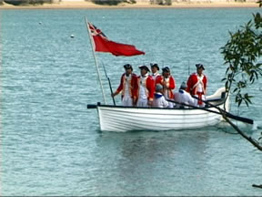
Excerpts from his journal describe
Cook’s procedure for departure: “…the pinnace (small
boat used to transport from the ship to shallow waters) went ahead,
which was ordered to keep sounding continually.”
History records they made safe passage
through the Great Barrier Reef through a channel known today as
‘Cook’s Passage!"
Vocabulary:
- soundings
(measurements taken of the ocean floor)
- fathoms
(linear nautical length of six feet)
- shoals
(shallow water)
- channel
(passage way through a reef system)
Materials:
- dishpan
or bowl at least 15” in diameter
- unopened
1-pint carton of milk/juice
- marbles
or comparable size rocks for weight
- pencil
- scissors
- ruler
Preparation:
- Create
cooperative groups to discover the principle of displacement as
you observe two model ships in the water.
- Groups
will test the ship design. Offer suggestions as to safer design
features for ships sailing in shallow waters.
Procedure:
- Without
opening the carton, measure 2 inches from the bottom. Draw a line
around the carton.
- Poke
a hole on the line and empty the contents of the carton. Cut around
the line to make two separate pieces.
- Fill
the dishpan with 2 inches of water. Float each half of the carton
in the water.
- Add
weights (marbles, etc.), one at a time, to the triangular-bottom
half (simulates the underside of the Endeavour). Keep track of
how many weights it takes to make the ship hit the bottom.
- Put
the same number of marbles into the flat-bottomed ship. Does the
ship sink when you reach the final weight?
- In
journals, record your ideas to the following:
If you
were Captain Cook, how would you have tried to sail the ship off
the reef?
If you
were a ship builder in the time of Cook, how would you make your
ships safe for island exploration?
Analyze
and Conclude:
- Were
you able to construct ‘boats’ to test the displacement
theory? Could you draw reasonable conclusions as to which boat
design would be more effective in shallow water travel?
- Did
you accurately record information and observations as you conducted
the displacement experiment?
- Does
your student journal reflect an understanding of the data gathered
from the experiment?
- Student
journal entries should provide information for island/coastal
exploration, i.e.take soundings to determine ocean terrain; ship
design to accommodate coastal exploration, and ideas of ocean
floor geography.
Management
Tip: use the print feature
in your browser to print this page out.
|