
Introduction:
Once
they left land behind, early navigators of Cook’s time relied
on navigational instruments from many cultures.
One of the most important insturments,
the astrolabe was a metal disk developed by Greek astronomers 2,000
years ago. It was held vertically and utilized a movable pointer
or sight that turned on a pivot that was aimed at the sun. It measured
the angle between a celestial body and the horizon, i.e. the sun
or the North Star. The pointer on the astrolabe would indicate the
sailor’s degree of latitude.
 |
What
is latitude and why were early navigators able to travel far distances
using instruments that determined it? Latitude describes the position
of a point on the earth’s surface in relation to the equator.
Latitude lines run parallel to each other from the equator north
and south. It is one of two points that describe position, the other
being longitude, which is determined by time.
Early navigators also used the compass.
The compass-invented by the Chinese to determine direction and widely
used by the Arabs-had come into use in Europe only about a century
before Columbus. Early compasses consisted of a magnetized piece
of metal on a straw. The straw floated in a container of water.
The quadrant, like its modern descendant
the sextant, was derived from an Arabic instrument, the kamal. It
was used to determine latitude by measuring the altitude of the
North Star or the sun above the horizon.
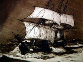
Captain
Cook had the most sophisticated celestial navigational equipment
of his day on board the Endeavour. To determine how far his ship
had traveled, he often used ‘dead reckoning’, essentially
guessing the distance by estimating the ship’s speed and how
far sideways the ocean currents and winds had blown it each day.
To determine Endeavour’s speed, a sailor would drop a cork
overboard off the ship’s bow (front), then see how long it
took the cork to reach the stern (end). The formula for figuring
dead reckoning is: course steered (heading) + time + speed + adjustment
(for currents and drift) = distance. (By the way, the term ‘dead’
reckoning’ comes from the term ‘deducted’ reckoning,
which, when abbreviated, was spelled ‘de-d’)
These
navigational aids allowed Captain James Cook to sail extensively
throughout the south Pacific and even as far north as Canada!
Vocabulary:
- Celestial
- Navigation
- Calculation
- Reckoning
Materials:
- Tagboard
- string
cut into 12” lengths
- Protractors
- 3/4
“ metal washers
- Pencils
- Journals
Preparation:
- Explain
the position of the North Star in relation to the Big and Little
Dipper. Point out that it is the only star in a fixed position
in the northern latitudes, thereby making it a point of reference
for navigators.
- Demonstrate
the use of a protractor. Identify its use in measurement of half
circles, i.e. 180 degrees.
- Collect
the materials listed above to create an astrolabe. Include reference
and resource materials that provide visual descriptions.
Procedure:
- Cut
a semicircle out of tagboard, the base being 8” in length,
the height 4”.
- With
the 8” base at the lower edge of the tagboard, the semicircle
facing toward the top, use a protractor to mark the degrees. Beginning
with 0 degrees at the midpoint of the half circle, label by 10
degree intervals down either side of the semicircle, ending with
90 degrees at either end of the 8” base. With the semicircle
facing up, the 0 degrees marking should be at the top.
- Tie
the 12-inch string to the middle of the drinking straw. Attach
it so it does not slip out of position along the straw.
- Tape
the straw firmly in place above the 8” base of the semicircle.
- Tie
a metal washer to the opposite end of the string.
- Locate
the North Star, then ‘fix’ your position by sighting
the North Star through the end of the drinking straw.
- After
the weighted string quits swinging, hold the string into place
against the tagboard.
- The
position of the string at the lower edge of the circle will indicate
your approximate latitude by the degrees indicated.
Analyze
and Conclude:
- Describe
how to locate the North Star. What is its importance in early
navigation skills?
- Identify
lines of latitude and their position to the equator, north and
south.
- Construct
a simple navigational instrument, labeling with reasonable accuracy.
Demonstrate the ability to locate present latitude with this instrument.
- Record
in your journal, descriptions indicating your success in the project,
listing difficulties encountered, observations, questions, and
relevant information pertaining to the use of navigational instruments.
Management
Tip: use the print feature
in your browser to print this page.
|

