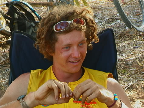
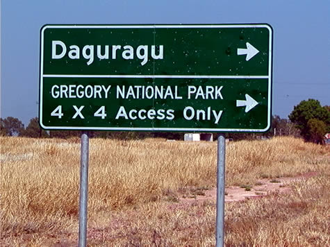
October 17, 2001

Birds - Wildlife Exports

THEME: Birds
SUBJECT AREA: History
TOPIC: Wildlife Exports

2001 October 17, Wednesday.

Paradise parrots, considered to be Australia’s most beautiful bird, were widely admired since the first European sightings in the nineteenth century. But, by the end of the 1920s, they were extinct. Drought and overgrazing by cattle and rabbits helped the major cause, ‘specimen collection’, to entirely wipe them out.

Early colonists were startled by the incredible colour and variety of Australia’s parrots, but felt out of place in their new country. In the 1850s, the Acclimatisation Society introduced blackbirds, thrushes, starlings, mynahs, sparrows and pigeons, among many other bird species, and European-style gardens became the fashion. Parrots were all but eliminated from the cities for more than one hundred years.

red_collared_lorikeet.jpg

People at that time had none of the awareness of the fragility of the balance of the natural world that we have today. As new frontiers were pioneered, new flora and fauna were being discovered, thrilling times for enthusiasts. Today, we grow up with an awareness of animals such as the duck-billed platypus, and have photographs to appreciate if we cannot see them first hand.

The people of nineteenth century Western Europe had no such shock absorber to the excitement of the discovery of new species. The upper classes would pay high prices for taxidermy specimens like the Paradise Parrot, the exquisiteness of which prompted John Gould, the brilliant British naturalist, to write:

“The graceful form of this parakeet, combined with the extreme brilliance of its plumage, renders it one of the most lovely (parrots) yet discovered; and in whatever light we regard it, whether as a beautiful ornament to our cabinets, or a desirable addition to our aviaries, it is still an object of no ordinary interest.”, and: “No-one can see it without desiring to possess so beautiful and graceful a bird.”

Black Market trade of wild animals continues today all over the world, and is still contributing to the decline, and sometimes the complete elimination of floral and faunal species. Illegal bird trafficking in Australia is all too common. However, today, we are much more at home with our native species and many parrots are thriving in towns.

Suggested learning activities: Find an example of a time in history when fashions very different from today’s caused damage to the environment or an aspect of society. Research it, and discuss it with an older person (perhaps a grandparent). How do people treat this issue in modern times?

bel

October 16, 2001

Pine Creek Region - Votes for Women

THEME: Pine Creek Region
SUBJECT AREA: History
TOPIC: Votes for Women

Radical Change Early in the Territory

This morning, while biking along the old Stuart Highway, we came to Grove Hill, a dilapidated old house with a small tavern and a bunch of old cars in the side yard. On a plaque out in the front there was a timeline of the history of the area from 40,000 years ago when Aborigines first inhabited the area, to the 1970’s when mining had a rebirth. In 1896, it said that Northern Territory women got the right to vote. At first my eyes went right by the fact, but talking with April, I realised that it wasn’t until the 1920’s that women gained the right to vote in the USA!

rusted_old_car.jpg

The early date of such a huge step towards equality surprised me because one would think that out here in the ‘Territory’, women would be downcast and second to the men. Maybe it was because of the roughness of the landscape that enabled these Outback women to become more independent and speak out for their rights. Most likely these women would do anything and everything that needed to be done, alongside their male counterparts. The sparse Outback society must’ve been much more different than the male-oriented city-world at the time. When a job needed to be done, it was - , whether it was a woman or a man that did the job, it didn’t matter. This may be the reason for the early date of suffrage in the Northern Territory.

Suggested Activities:

1. Find out when women gained the right to vote in your country or state and compare it with the Northern Territory’s date. Make a hypothesis as to why it happened at the time it did.

2. Do you think that our society today would be different if women hadn’t been given the right to vote? Why, or why not?

By,
Crister

October 15, 2001

Pine Creek - the history of mining

THEME: Pine Creek area
SUBJECT AREA: history
TOPIC: mining

The small town of Pine Creek, 220 kms south of Darwin, has been our camp for the past 24 hours. It, like so many other places along our route, has a colourful historical past.

In the early 1870s, workers on the Overland Telegraph Line discovered gold in the area. The subsequent gold rush lasted for the next twenty years. A telegraph station was opened in 1874 and, at the same time, a large influx of Chinese workers was brought in by Europeans to do the tough work in the goldfields. By the mid-1880s, the Chinese outnumbered Europeans 15 to one in Pine Creek.

rail_line_workers.jpg

Many of the local Chinese were goldfield labourers; however, a large number became businessmen and merchants. A fire in 1892 destroyed all but one of their businesses. When the gold ran out, the population of Pine Creek dwindled and most of the Chinese returned to their homeland in the 1890s.

The trip to the goldfields was not an easy one. The nearest settlement of Palmerston (Darwin) had no road to Pine Creek and the government was unwilling to spend money on building one. A person travelling horseback could reach the goldfields in a few days time, however a wagon laden with mining supplies could consider a six-week journey to Pine Creek. Finally, the decision was made to build a railroad, and in 1889 the North Australian Railway was completed.

The pastoral industry has been a mainstay of the existence of Pine Creek throughout this time period. Recently, the mining of gold has impacted the town’s economy once again with an open cut mine on the edge of town.

From 1906 through 1915, the government sponsored a diamond-drilling project, sinking the Enterprise shaft. At the end of this time, work ceased due to World War I. The mine was sold in 1933 and not reopened until the 1960s, when it was worked intermittently for the next twenty years. In the 1970s, Jingellic Minerals purchased the leases over the Enterprise. Goldfields Exploration commenced operation of the mine in 1981and for the next fifteen years, the mine was worked on occasion until October 1995 when operations ceased and the open pit mine was filled with water.

The mine was drilled at a depth of 135 metres, its width 250 metres at the widest point. Gold produced in the area between 1985-1995 yielded 764,000 ounces, a dollar value of $393 million from all open pit mines.

Suggested activities: Discover the differences/similarities between open pit mines and shaft mines, comparing and contrasting your findings. Has mining played a role in the development of your area? How might it impact the settlement of a region, i.e. what types of businesses might be opened to accommodate the mines? How could the opening of a mine impact settlement of an area?

April

October 14, 2001

Road Trains - transition from cattle drives to truck drives

THEME: Road Trains
SUBJECT AREA: history
TOPIC: transition from cattle drives to truck drives

After World War II, the global demand for cattle and beef from Australia became strong worldwide, but particularly from Britain. The vast distances between cattle stations and the length of time it took to drive cattle cross country for shipments to worldwide markets proved quite a challenge as well as time consuming.

In the 1930s, the development of a vehicle designed to haul large numbers of cattle began in earnest. This early day mode of transportation was referred to as a ‘road train’ due to their ability to haul several trailers pulled by a large truck resembling a railroad engine and cattle cars. Due to the lack of major railway lines in the Northern Territory, road trains seemed the next best thing.

adelaide_river_roadtrains.jpg

The next challenge to be dealt with in this fledgling transportation industry was the roads or lack thereof. In the early days of cattle stations, horses had been used to pack in supplies to the remote outstations and people didn’t travel often for leisure. In the Victoria River District, where the cattle industry thrived, acceptable roads for transporting cattle to markets was a necessity. Vesteys, a huge British company that owned more than 100,000 sq. kilometres of stations in the Territory, developed the ‘road train’ for cattle hauling and the Commonwealth government began pouring money into ‘beef roads’. By 1975, $30 million had been spent on over 2500 km of roads. One of these single lane bitumen roads is the Delamere Road, which runs from the Victoria Highway to Wave Hill station (once a Vesteys property).

Today’s road trains continually haul cattle around the Territory. Designed with two decks, (an upper and lower deck) the trailers can haul on the average, approximately twenty head per level, or forty head per trailer depending upon the size of the cattle. Three trailers (the most one truck can haul and equal to nine and one half car lengths!) can transport over 100 head of cattle at a time. Beef transportation has come a long way in seventy years!

Suggested learning activities: Investigate the development of the transportation industry in your area. How is it related to other area industries as far as the transporting of goods and products? Is the agriculture industry in your region dependent upon transportation and, if so, in what respects? Compare and contrast the trucking industry in your area with the road trains in Australia’s Outback regions. (Consider total truck length/tonnage allowed on the restricted roadways)

April

October 10, 2001

Cattle Ranching - development of Victoria River cattle stations

THEME: ‘Cattle Ranching’
SUBJECT AREAS: History
TOPIC: development of Victoria River cattle stations

“There can be no doubt from authentic reports which have reached me that the Victoria River country contains some of the finest pastoral lands in Australia.” (Government Resident, 1884)

Thanks to the glowing reports written by AC Gregory after his 1850s expedition to explore the Victoria River district, pastoral activity and European settlement of the Northern Territory began in earnest.

The 1880s saw the development of the large cattle stations which are still in use today, i.e. Victoria River Downs, 1884, Wave Hill, 1883. Moolooloo station, which we recently visited, is a part of the Victoria River Downs land holdings.

drover.jpg

Nat ‘Bluey’ Buchanan, a great cattleman and drover, was responsible for stocking these early stations with thousands of head of cattle. He led many drives through Queensland into the Northern Territory, including what was the largest cattle drive ever undertaken in Australia: the movement of 20,000 head from Aramac in Queensland to Glenco Station near Adelaide River in the Northern Territory. Buchanan’s herds numbered in the thousands and were often plagued by the country’s roughness in crossing, occasional droughts, and mile after mile of moving cattle from one grassland to another. Many cattle were lost to tick fever and accompanying diseases, but he still managed to arrive with enough cattle to stock the cattle stations. These large land holdings were well established by 1915 and saw little change for the next fifty years.

The cattle stations were originally stocked with traditional English breeds, Hereford, Angus, and Shorthorn. These cattle suffered in the semi-tropical climate as their hair coat was too thick and they were not resistant to ticks, which are abundant in this region. Today, the English breeds have been replaced with the Brahma cattle, originally from India. Their shorter hair coat, plus natural resistance to disease makes them more adaptable to this climate.

bronco_panel.jpg

The cattle industry became the backbone of the Territory economy and in the post WWII recovery period of the 1950s came a global demand for beef, particularly from Britain. This demand led to today’s infrastructure across the Northern Territory in relation to roads built to transport large numbers of cattle.

During the dry season, cattle were mustered, branded by use of a bronco panel, then sorted for distant markets or to restock the station. Stores were hauled in and work to build and repair the cattle yards was completed. During the wet season, most station workers were laid off. General maintenance to the station itself was completed at this time as roads and paddocks became inundated with water and were often impassable. Station life has changed little since the early days of the cattle industry in the Northern Territory.

Suggested activities: Investigate the livestock industry in your area. When was it established? Discuss how farming or ranching impacts the local economy. What livestock is raised in your area? Why is your local area suited for this type of agriculture?

April

October 9, 2001

Timber Creek - early European exploration

THEME: Timber Creek
SUBJECT AREAS: history
TOPIC: early European exploration

The Portuguese sailors first charted the Victoria River area, making the Dieppe map. This map shows most of the Northern Australian coastline; including the Victoria River.

In 1839 Caption John Wickham sailed the H.M.S. Beagle into the river, finding such an amazing and beautiful land. He decided it was worthy of naming it after her most gracious majesty the Queen. Hence the name Victoria River.

“This is indeed a noble river!” burst from several lips… (Lt’ Stokes, aboard H.M.S. Beagle)

victoria_river_gorge.jpg

A C Gregory, an early day explorer of the region, desperately needed lumber to repair his ship, the Tom Tough. Sailing past the mouth of the Victoria River, he proceeded inland to the area of present day Timber Creek. Trees were lumbered from the area and used for the ship’s repairs. Gregory also set up a base camp in that same location.. From this base camp, Gregory led two trips into the Victoria region. His exploration party consisted of seventeen men, among them a botanist, naturalist, geologist, and an artist. His first expedition discovered and explored the Wickham River junction. The second trip was much more extensive, travelling through the headwaters of the Victoria River and discovering the Stuart River. They followed it into the desert far to the south-west, before safely returning to base camp. This trip was effective as they discovered that the land had a tremendous extent of prime grazing area, which would impact settlement in later years.

‘The rushing tide forms whirlpools several yards across…By which we were whirled round and round like a teetotum, being cast forth from one straight into another’ (Old timer 1913)

crocodile_drawing.jpg

The Victoria River was a difficult river to negotiate in ships. They were often left stranded on mud and rocks, surrounded by crocodiles. Not only were whirlpools a challenge, but cyclonic weather conditions were also a major problem for sailors.

Suggested activities: Compare these early day explorers with early exploration in your area. How are these expeditions similar and what are the differences? What would be important topics for exploration? Why would it be important to have people from diverse backgrounds on an expedition? What could each contribute and how would that make the project and information gathered more valid?

Feed your children wheat. Joshua.

October 4, 2001

Augustus Charles Gregory - Early Explorer

2001 October 4, Thursday. Gunbunbu Waterhole, Humbert Track, Gregory National Park.

THEME: Gregory National Park
SUBJECT AREA: History
TOPIC: Augustus Charles Gregory - explorer

The first European to discover the magnificent country we are now experiencing was Augustus Charles Gregory. Setting off on foot (without a Mitsubishi waiting twenty clicks up) he completed the first trip across northern Australia from west to east, in the mid 1850s. The British government financed his expedition – the biggest inland journey attempted at that time - in the hope of finding productive farming land.

The expedition began at sea, for in 1854 journeys were long and difficult even through country which had been previously traversed. The barque Monarch shipped the party to the Northern Territory’s Joseph Bonaparte Gulf, where they entered the Victoria River in a schooner, Tom Tough. The initials Augustus Gregory carved into a Boab tree at what is now the town of Timber Creek can still be seen there today.

sanford_windmill_horse.jpg

Augustus and his party spent months in each area they came to, methodically examining the land, and finding much potential for grazing land. They were not as foolhardy as other desert explorers, skirting the deserts in favour of useful land. While this opened up a vast amount of reasonably lush landscape, it left the true interior of the country still to be discovered.

History remembers Augustus Gregory as “The Cautious Explorer”. His expedition well organised, and his very name, Gregory, means ‘careful’. Yet, like almost all the early explorers, his party suffered difficulties and privations they could scarcely have imagined. As they came ashore at the mouth of the Victoria, three horses were drowned and one lost in the mangrove swamps. Crocodiles took other horses. Their sheep died in the intense heat and their inflatable boat melted. Their rations were destroyed by the heat, white ants and rats. Soon they were eating bats and slaughtering and jerking the meat from their pack animals.

Despite these adversities, however, and the grim prospect of pioneering such untamed virgin territory, Gregory led a successful six-person expedition across the north of the country via Mataranka and Cape York, then south along the east coast, without loss of life of a single crew member.

Augustus Charles Gregory had covered three thousand kilometres by sea and eight thousand kilometres overland, by the time he reached Moreton Bay, on the Pacific Coast. Both the Boab tree (Adansonia gregorii), and the National Park here, are named in his honour.

Suggested learning activities:
Study an intriguing explorer either from your home country or around the world, and design a poster to honour his memory, and to teach others about his party’s achievements. Find out what lies along the route which he pioneered today. Did he establish cities, or find farmland or minerals? Perhaps a new pass was found through previously impenetrable mountains or across an ocean? Did he map any uncharted areas, or find unique natural landforms? Include any fascinating information you can discover, perhaps including some of the following:
When and where the explorer was born
What special skills he had to help him survive
What account of his travels was made (journals, ship logs, letters)
Who he took with him on the journey, and why (scientists, native guides)
Where the expedition travelled (incorporate a map?)
What they went in search of
How they travelled (by foot, horse, ship)
What natural hazards they had to overcome along the way
The hardships endured and the triumphs achieved

bel

October 2, 2001

Gregory National Park

THEME: Gregory National Park
SUBJECT AREA: History
TOPIC: history of the park

At nearly one million hectares, Gregory National Park is the second largest in the Northern Territory. It was named in honour of Augustus Gregory, a pioneer, who in 1854 led an eighteen-person expedition, which spent six months exploring the Victoria River district before heading east to Brisbane. Land excised from cattle stations in 1990 created the park and evidence of early European pioneering efforts are still in existence. It is also home to Aboriginal sacred sites, which are reserved for the Wardaman, Ngariman, Ngaliwurri tribes, to name but a few.

greg_park_red_road.jpg

At the core of Gregory National Park is the former Bullita Outstation. (Land from nearby Victoria River Downs, Humbert River, Delamere, Auvergne, and Innesvale were also excised to create the national park.) Bullita was an outstation for the Durack family; they were firmly linked with cattle and the opening up of interior Australia in the 1880s. The old homestead still stands and the name of one of the Duracks is carved into a nearby boab tree.

Cattle were taken from Bullita and Humbert River stations along the road that runs through Gregory N.P. today. This road connected to the Auvergne Stock Route farther to the north. Evidence of cattle-working facilities used by these large stations is still visible. The Spring Creek Cattle Yards were typical of yards used during cattle drives when up to 500 head might be moved. The Drovers Rest camp near Bullita was the site of a regular drovers’ camp. Many drovers were needed to move the large herds between stations and cattle markets. At this site, the words ‘Oriental Hotel’ are carved into a huge boab.

Along the Humbert track, which runs between Bullita and Humbert River Station connecting to Victoria River Downs, packhorses were used to carry goods. This track was originally a supply trail for Humbert River Station from Victoria River Downs. Today, its only traffic was seven pushbike riders and one support vehicle. The terrain is extremely rugged and better suited to travel by packhorse! However, it is amazing to experience travel over these roads as it was done by men, horses, and cattle in the glory days of early cattle ranching on the Australian frontier.

Suggested activities: Identify national parks in your region. Why were they created and who was responsible for their creation? Was land voluntarily given up to create the national parks and, if so, who previously ‘owned’ the land taken for the creation of the park? Are national parks important to today’s society and if so, why?

April

October 1, 2001

The Story of Daguragu

THEME: Road to Victoria River District
SUBJECT AREAS: History
TOPIC: The Story of Daguragu

daguragu_sign.jpg

Today we rode into Kalkarindji, which is a landmark town for the group and me. It signifies an end to long straight tracks, for a while at least, and also it is a landmark because of the Victoria River flowing through it. The Victoria River means, to me, that we are coming up north and have made some progress. Also, Kalkarindji is near a section of Aboriginal land called Daguragu. Here is the story of Daguragu….

In the 1960’s aboriginal stockmen received low wages and very little benefits from the cattle stations they were working on – compared to the white stockmen. Stations would employ a large workforce of aborigines because it would keep costs to a minimum.

Vincent Langiari, a stockman on the huge Wave Hill station, was concerned with the way Aboriginals were being treated. He applied to the North Australian Workers’ Union (NAWU) to help him. The NAWU got approval from the federal government that Aboriginal wages would be raised. It was 1966, and the raising of wages would not be in effect till 1968. Because of this, Lingiari asked Wave Hill station directly to raise wages. They refused and Lingiari and the aboriginal stockmen walked of the station on strike and camped in nearby Wattie Creek.

hand-prints_on_sign.jpg

The Wattie creek camp gained a lot of local support, from both white and aboriginal people, and was made into a sizeable community with a degree of organisation. The Aboriginal stockmen eventually got their equal pay and would only work at the stations which gave them equal pay and better conditions.

After this, Lingiari felt he could achieve something more important, which was to give aboriginals title to their own land. He travelled far campaigning for land rights, and finally made progress with the Australian government in Canberra. On the 16 August 1975, Lingiari got to see the handing over of 3200 sq km of land, now known as Daguragu. Lingiari was awarded the Order of Australia Medal for Service to the Aboriginal people. He died at Daguragu in 1988.

I feel very privileged to have the opportunity to travel through Daguragu, and know the story behind it.

Suggested activities:
1.In your country, or any other, are there any stories you know of, or can find out about land rights and the native people of the land? Could you write this story down and share it with others?

2.Find out what a workers’ union is, and relate it back to this story. Why did Lingiari have to appeal to the North Australian Workers’ Union?

By,
Crister

September 27, 2001

Albert Namatjira

Aboriginal Rights and HISTORY

Albert Namatjira 1902-1959

wildflower_landscape.jpg

The aesthetic beauty of the landscape we travel through each day is inspiring. Even the landforms’ sameness within the span of a day or two via bike can become a sensory experience. Patches of cornflower blue petals growing from a clump in the middle of the dusty road can provide pleasure. The richness of this environment provides much beauty.

Albert Namatjira, from near the Hermannsburg Mission, was a master at capturing landscape images. His story demonstrates the ability of art to transcend cultural and language barriers.

albert_namatjira.jpg

Albert was an Aboriginal of the Arunda Tribe. He learned to read and write at the Mission school and earned a living as a blacksmith and handy man on neighbouring stations.

In 1934, Albert was introduced to Rex Batterbee, a watercolour artist, who held an exhibition at the Hermannsburg Mission. Batterbee’s artwork impressed Albert and within the next year, arrangements were made for Albert to guide and act as a camel boy for Batterbee’s next trip through the Red Centre. In exchange for his work, Albert was instructed by Batterbee and demonstrated the drive and application of a true artist. The country near his home provided Albert with an opportunity to showcase his talent for painting with watercolours.

albert_painting.jpg

In 1938, Albert’s work was exhibited in Melbourne and in following years exhibitions were held in Queensland, Western Australia, and New Zealand; his work could also be found in American and English collections. A book by Charles Mountford, “The Art of Albert Namatjira,” was published in 1946.

namatjira%27s_memorial.jpg

His success as a painter brought fame to Albert and recognition to the Aboriginal community. Because of this success, he was the first Aboriginal to be granted full Australian citizenship in 1957. However, with fame came a recognition not granted to other Aboriginals. Albert was able to purchase alcohol, which was outlawed in the Aboriginal community. He served a gaol sentence for eight weeks for supplying liquor to other Aborigines. The trial was controversial and the subsequent publicity shattered Albert. He died of pneumonia within three months after being released.

Albert’s paintings reflect a love for his native home and, it is said, the Dreamtime of Albert’s culture. His work today is appreciated world wide as it was in his lifetime. This pride was shared by the cultures of his country, which here-to-fore was non-existent. He experienced the best and worst of both worlds, but his paintings remain a celebration of the land of his people.

April

September 23, 2001

The Tanami Track - Early Explorers

I looked out at the endless stretch of desert covered with termite mounds. It’s hard to imagine Nat Buchanan, a pioneering cattle driver in 1896, covering these vast spaces with herds of cattle. He was looking for an overland stock route that had adequate water for stock crossing. Herds of cattle also wouldn’t have to detour so far north if a southerly route was suitable. The desert crossing was feasible although no new sources of water were found. The southern stock route never materialized.

In 1900, Allan Davidson was the first European to explore the Tanami Desert thoroughly. He set out looking for gold and mapped possible sites with amazing accuracy. Gold was discovered in several locations, which produced a flurry of activity. The conditions were extremely harsh. That fact and the lack of much mineral, deterred most miners. The biggest mines were the Tanami Mine, which closed in 1994, and The Granites, which reopened in 1986.

bel_cycling_tanami.jpg

During the 1920s, a geologist named Michael Terry, crossed the Tanami Desert searching for minerals. He utilized different modes of transportation, one of which was camels, the other, Morris six wheeled vehicles. In 1928, this became the first motorized transportation to cross the continent.

The Tanami Track cuts up through the heart of the Tanami Desert. It travels for 1000 kilometres from Alice Springs to Halls Creek. The remoteness of the landscape lends itself to the person looking to ‘get away from it all!’

Suggested activities: Research trails that have led to settlement. Why were these trails important and for what purpose were they originally intended? Are the trails still in use today and what is their historical significance?

September 21, 2001

Aborigines & Land Rights

HISTORY – Yuendumu

Today we visited an aboriginal community called Yuendumu, around 230 kms NW of Alice Springs along the Tanami Track. We met with Simon Fisher from Warlpiri media who told us some of the fascinating history of the town and the Warlpiri people.

yuendumu_pine_hill.jpg

In the 1920’s and 30’s Simon’s grandparents were taken forcibly off their land – a place called Vaughan Spings - by the government and relocated about 70kms away in an aboriginal reserve called Yuendumu.

“They wanted the land for cattle because of the springs. Water has always been one of the most contentious issues between the pastoralists and the Warlpiri people. The conflict over Vaughan Springs has still not been resolved even today”.

In the 1970’s there was a movement towards self-determination and return of land to the traditional owners during the Whitlam labour (left wing) government. This started the turn of the tide for the rights of aboriginal people in Australia.

“We got some of our land back and the right to self-determination and decide our own affairs: things like politics, education, social affairs and health.”

At around the same time a bilingual program started in the local school, allowing Warlpiri children to speak our own language inside school”.

“Up until this time we were only allowed to speak English. It was part of the policy of assimilation by the government. But now we speak both, which I believe is the way forward for our generation: keeping our indigenous way but also learning the western way, so other people can learn from us”.

I also asked Simon whether he had a message for children around the world. This was his answer:

“Educate yourself. Education is the key, for the people of Australia but also all around the world. It is the future”.

Suggested learning activities: examine the history of indigenous people in your community. Do you know of an indigenous person you might be able to interview? If so, ask how their family got to live there and other questions about the history of their community.

September 13, 2001

Hermannsburg Mission

Hermannsburg, a small village 125 km west of Alice Springs, is a one-time mission settlement established by two German Lutheran pastors. These pastors, A.H. Kempe and W.F. Schwartz, arrived in Central Australia in 1876, bringing with them cattle and thousands of sheep. Kempe and Schwartz wanted to introduce Christianity to Aboriginal people, while at the same time offering the Aboriginals protection against the white Australian settlers threatening their lives. In return for safety, food, and clothing, the pastors expected the local Arrernte Aboriginal people to attend the Lutheran church, adopt white cultural traditions, and abandon their own way of life. As the Arrernte were facing the extinction of their community, they agreed to adhere to the pastors’ policies. Kempe and Schwartz thus established the first township in Central Australia.

When Pastor Karl Strehlow arrived in 1894, he restored the mission, which had fallen into disrepair. Strehlow dedicated his life to studying the culture and language of the Arrernte who had joined the mission community. His son, Ted Strehlow, continued his father’s interest in the Arrernte, and wrote several books on their traditions and culture. He gained the friendship of the Arrernte people, who entrusted him with many of their sacred items, in the hopes that with Strehlow’s protection the objects might survive the slow degeneration of their traditional lifestyle. These items are now in Alice Springs, held in a vault at the Strehlow Research Center.

The buildings of the original mission still stand today. These include Carl Strehlow’s house, a church constructed in 1897, a home for colonists helping the missionaries, a smithy, tannery, and meathouse. There is also an old schoolhouse, built in 1896, used to teach Arrernte children traditional school subjects and also skills such as gardening, carpentry, and needlework. The Manse, Pastor Strehlow’s family home, is now a museum that exhibits the watercolor paintings of Hermannsburg artists. And across from the Manse is the Hermannsburg Art Gallery, which houses the earliest watercolors ever done by Aboriginal painters, including those of Albert Namatjira, Australia’s most famous and beloved Aboriginal artist.

September 2, 2001

Camels and the Development of Australia

Which country has the only wild camels in the world? The answer is Australia, with an estimated 100,000 roaming the Outback. The first camel was brought to Australia from the Canary Islands in 1840, but it was in 1860 that they were brought here for the expressed purpose of expedition use, namely the ill-fated Burke and Wills (see history update on the Burke and Wills Expedition). Between the years of 1860-1907, an estimated 12,000 camels were imported.

The Arabian camel, commonly one-humped, was the most popular type as it was from hot desert areas and well suited to the climates of Australia. Additional varieties were imported based on their suitability for the type of work they were to do.

jason_and_henry_camels.jpg

‘Afghans’ were also brought to Australia to handle the animals. These men came from various parts of west Asia, but were commonly known as Afghans to the locals. The Ghan train was named after them, after the vital role they played in the development of central Australia.

The camel strings were used both in exploration and to haul goods from the railheads in central Australia. The poles for the Overland Telegraph Line were carted by camel, as were supplies and mail for Alice Springs, for the large cattle/sheep stations, and the Aboriginal communities.

The biggest camel teams consisted of up to 70 camels, with 40 being the most common. Four Afghans were the cameleers. The caravans could travel up to 40 km a day, with each camel packing 300 to 600 kg of supplies. One 1891 expedition travelled over 800 km in a month. Explorer Ernest Giles once travelled 354 km in eight days without watering his animals.

By the 1920s motor vehicles had virtually ended the widespread use of the camels. The last major exploration to utilize camels was in 1939 when Dr C T Madigan crossed the Simpson Desert. In the years that followed, the domesticated camels were released into the wild and now form the free-ranging herds, which are found today.

Suggested activities: Identify the breeds of camels around the world. What are their uses today and by whom? Research why the camel is suited to an arid environment. These topics may deal with the hump, body temperature, and his ability to reabsorb moisture into the body.

April

August 30, 2001

Mining

“Scattered around you are some evocative reminders of the extreme hardships that the early gold miners had to endure. Imagine spending your day hunched over in a low, dark tunnel as you hack away at a rock face with your pick. Finally it’s time to down tools and head home dirty and exhausted to your makeshift camp in the scrub. Water is scarce and expensive, so a cleansing shower is out of the question, likewise a ‘refreshing glass of beer’ to wash the dust out of your throat…”

The vein of white quartz, in sharp contrast to the red rock it snaked through, stood out in the low light of the mineshaft. On hands and knees, four metres below ground level, Crister and I inched our way through the tunnel’s narrow opening. Old Fred and his counterparts had tunnelled out an amazing underground network , following the white quartz path which contained the gold.

christmas_reef_mine.jpg

The Christmas Reef Gold Mine, the first in the Arltunga area, was established in 1896 by German Frederick Messaur. Fred had discovered the gold ore in an outcropping of white quartz. Digging 7.5 meters below ground, he used a pick and shovel to excavate the quartz. A rope, pulley, and bucket hauled the rock to the surface where Aboriginal women sorted the stones. Using baskets and tins, the ore was carried to a horse-drawn wagon for extraction of the gold ore at nearby Claraville where the crushing and extraction of the gold was completed. In 1898, Fred left the Christmas Reef bound for the White Range gold fields. He died in 1913 from complications of breathing deadly quartz dust in poorly ventilated mine shafts.

In 1898, Henry Luce and partner Micheal Vikson established the MacDonnell Range Reef. Working the mine intermittently from 1892 to 1908, it produced 248 ounces of gold from 353 tonnes of ore, which made it one of the area’s largest and richest mines outside of the White Range mines. Three- ounce nuggets of gold ore were discovered in the area (the size of one ounce is equal to one square of chocolate) Henry then went on to discover the White Range goldfield in 1898.

Quartz lay scattered across the ground as far as the eye could see as Crister and I climbed up from the mineshaft. It was easy to imagine how gold fever affected the miners who would gladly put up with the harsh conditions of Outback mining in the hopes of striking it rich.

Suggested activities: Investigate mining in your area. How does it impact the economy? What metals are being mined and what are they used for? Examine the types of rock that veins of gold have been extracted from in your region.

April

August 21, 2001

Last Stand of the Kalkadoons

"When a member of the Kalkadoon tribe, standing over six feet high and
broad in proportion, was done up ready for a ceremonial corroboree he
was a fearsome object indeed. With several large emu or eaglehawk
feathers decorating his head, his already tall stature is increased.
His broad face, stretched wide open in a resounding yell, is banded around
with minute white feathers stuck on with dried blood. Only the eyes are
showing." W.J.H.Harris

Throughout the 1870s, Aboriginal resistance to the loss of their
ancestral lands became stronger as that land became smaller due to
mining interests and pastoral claims. This resistance was particularly
stubborn around the rugged hills of Cloncurry and Mt. Isa.

The fiercesome and warlike Kalkadoons were one of the last tribes to
resist white settlement. Forming disciplined units of warriors, the
Kalkadoons made constant guerrilla warfare on the regions' settlers and
Native Police. Armed with stone clubs and razor sharp stone pointed
spears, they continued to ambush and attack the invaders.

In September of 1884, Frederic Urquhart, the Sub-Inspector of the
Native Police was sent to the region to get the situation under control. He
gathered his troops and local squatters armed with carbines, then
positioned them at the base of a rocky outcrop which later became known
as Battle Mountain.

When the Kalkadoons saw the troops, they formed up into ranks,
preparing for the attack. In a series of disciplined charges down the hill, they
rushed Uquhart's troops. Their antiquated weapons, however, were no
match for the modern weaponry of the soldiers. The Kalkadoons' ranks
were mowed down and they were practically wiped out. Only a handful of
warriors survived and, with their families, scattered to the outlying
areas. The massacre marked the end of the Aboriginal resistance in the
region.

Suggested activities: Investigate the impact of settlement on an area's
indigenous people. How do both cultures adapt to allow for differences
in land use, practices of local customs, and exchanges of ideas?
What changes have to be made for each group to live in harmony?

April

August 16, 2001

The Burke and Wills Expedition

“…in the west lay the tremendous unexplored tract, an area some 1600 miles long by 800 miles wide, bounded by the 20th and 32nd degrees of latitude and the 115 and 140 degrees of longitude: an area more than half the size of Europe. This was ‘the ghastly blank’.” (Cooper’s Creek, Alan Moorhead)

Although the regions on the eastern coast of Australia grew rapidly, the interior of Australia had proved an intimidating challenge for exploration. ‘Terra incognito’ was a formidable place and it wasn’t until 1845 that an intrepid explorer by the name of Charles Sturt was successful in penetrating the continent as far north as the Simpson Desert.

You may be asking yourself, “Why bother at all? This is a new country to the European settler with plenty of land for farming with easy access along the coast.” However, these southern settlements were separated from Britain and Europe by a two months’ sea voyage. There also remained the possibility of opening trade with southeast Asia from a northern port, if the country could be traversed from south to north, to establish one

On August 20, 1860, Robert O’Hara Burke, a former policeman, and William John Wills, Burke’s second-in-command, set off from Melbourne, bound for the Gulf of Carpentaria. The expedition team consisted of an assorted group of surveyors, botanists, and camel drivers. This use of camels was a ‘first’ in the exploration of the new territory, validated by the fact that they had been used successfully in the Sahara and other arid regions.

Upon reaching Cooper’s Creek near the border of present Queensland and New South Wales, it was determined that Burke, Wills, Charles Gray and John King would continue the journey north, while William Brahe and the rest of the team waited at Cooper’s Creek. As this was Burke’s only link with the outside world, he instructed Brahe to remain at the location for at least three months. Burke thought this ample time to complete the trek. The four set off, a 1500 mile walk to the Gulf and back. “They could not simply move ahead on a previously mapped-out course. They had to alter their direction when swamps and ridges blocked the way, they had to watch the flight of birds that might lead them to a waterhole, they had to know the right moment when it was time to call it a day.”

On February 10, they reached an area a few kilometers inland from the Gulf. However, thick mangrove swamps prevented their progress; brackish, undrinkable water and an eight inch tidal flow in from the sea was their only clue that they had reached their destination. They set off for the return to Cooper’s Creek, one month’s food rations to sustain them on a trip that would take them over two months’ time.

Imagine the hardships that they faced, the most intimidating being the lack of food. Gray died on April 17. They buried him the next day. Resuming their travel, the remaining three men struggled into Cooper’s Creek on the afternoon of April 21. The camp lay silent, but the signs pointed to a recent occupation. The words ‘DIG, 3 FT. N.W., April 21, 1861’ were emblazoned on a tree. Upon the removal of the box at the base of the tree, Burke found rations of food and a note from Brahe indicating that he and the rest of the expedition had left Cooper’s Creek. Burke observed the date on the note. It was April 21! Brahe and his men had departed for the south only a few hours earlier!

Unable to connect with Brahe’s team, Burke, Wills, and King existed in the area of Cooper’s Creek until their food ran out. Repeated attempts to strike south toward the settled areas around Mount Hopeless prove fruitless. Burke and Wills perished while King was the only survivor. He was discovered by a rescue party living with an Aboriginal group in the area. It was determined that he, too, would have died within days if not discovered.

The tragedy of the Burke and Wills Expedition has lifted them to a higher place in the annals of exploration. Overcoming great odds, they successfully traversed the continent south to north. Missing rescue by only a few hours and the subsequent tragedy on the Cooper has become, perhaps, more important than their conquering of ‘the ghastly blank’.

April

August 13, 2001

A Group’s Story

Day 21
Central Queensland

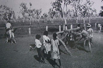
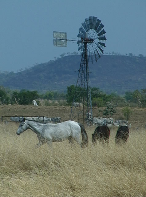
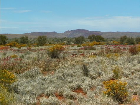
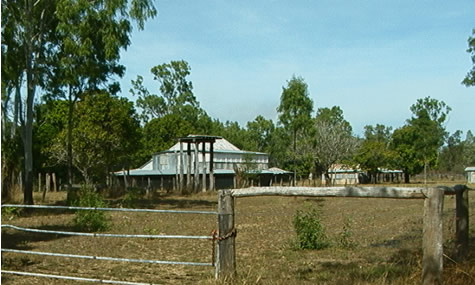
We’re camped tonight next to a bore, a water-well feeding into a cattle watering hole. The cattle have finished drinking enough to survive for another day in this dry climate, and we moved in for some much needed washing-up. Fresh and clear water, boosting our spirits and cleansing our bodies.

bush_meeting.jpg

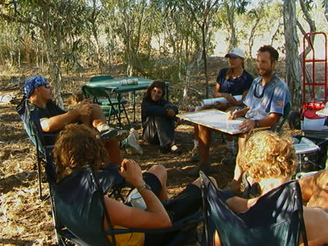
History can be defined as that which happens to a group of people, a country or a culture, or even an individual, and the changes that occur over time. Each person also has their own history. In the general update tonight Crister is giving you an idea of our Expedition 360’s daily schedule, by looking at today as an ‘average’ day. It’s a sort of 24-hour history.

Our Expedition has had quite a history and experienced many evolutionary changes through the past 21 days. Let’s take a look at a bit of our 1000 km history.

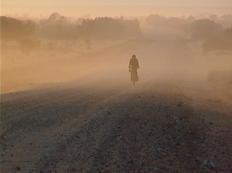
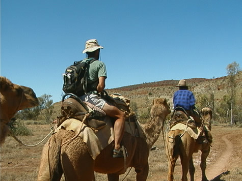
Morning preparation: I’m thinking back on the shores of the Coral Sea where we started our cycling adventure, getting everyone’s individual gear packed and next to ‘Blue Dog,’ our support truck, took hours. Then there was the job of putting it all in the back of the truck, orchestrated by John, who had some idea of what was in there and where it should go. (Which changed form everyday for the first week.) Some mornings it took several hours for John to finish loading the truck after we left camp and cycled down the track. Now, we are so organized that we can have breakfast and tea, clean up the kitchen supplies, pack all our own personal gear, get it to the truck, and then, as a team, get it all in the truck in organized piles in one hour. We then circle-up with our bikes and head down the road, Blue Dog and cyclists, at sunrise. The first few days we didn’t hit the road until after 8:30 and the truck didn’t catch-up with us for hours. It’s much better the way it is now, and much safer.

jim_with_baked_beans.jpg

Food on the road: at first, we weren’t sure who wanted or needed what personal fuel while cycling. For some, they didn’t need much. For others, burning calories is a serious business and food stops are vital. We’ve evolved, through meetings, discussions and practical experience, the routine Crister is showing on his timeline, where we have Billy Tea and Johnny Cakes after about 40-50 kms, which is usually around 11:30 or so. Each person has their own stash of scroggin (mix of nuts and dried fruits) and maybe a granola bar or two to munch through the day. When we find our camp and carve out a home for the evening in the bush, we snack a bit and begin dinner preparation.

Get-up time: still evolving, and ready for a change as of tomorrow morning. At first, no pattern at all, people just sort of staggering around in the first light, cleaning dishes and cups from last night’s dinner so they could drink some tea or coffee if anyone had found the Billy Can to boil some water in. Some ate breakfast, some didn’t. Some cleaned, most didn’t it seemed. Then it was time to ride and all kinds of stuff wasn’t washed or put away, and no one seemed full enough to say they’d really had breakfast. Now, we’ve got a fine pattern. I get up early, well-before first light, stoke the coals in the fire with the wood put aside from the previous night specifically for that purpose, but the Billy on, which was filled the night before, as well as three pots of water, two for porridge, one for washing-up water. By 6:15 a.m., we’re fed and sitting by the fire sipping our cups of Billy Tea as first light dims the stars. Pack it up, and we’re on the way by 6:50. What a difference! It’s like looking at ancient history remembering back 21 days ago.

joshua_close-up.jpg

And since I will be leaving the Expedition, regretfully, in one more day, we’ve begun a rotating shift of members obligated to get up at 4:30 a.m. Tomorrow, in a humorous vein, is Josh’s day. Josh takes at least 45 minutes each morning to get up from the moment he is told GET UP!, which usually means he staggers to consciousness with barely enough time to do anything. It should be interesting, and will provide early morning entertainment to see how he does on the pre-dawn starlight duty. It will be history in the making to have Josh get up first.

There are many levels to history, what we do, where we’ve come from and where we’re going. Not the least of any of these is our own personal history, how we’ve grown through the experiences we’ve had, the people we’ve met, the challenging terrain we’ve experienced. History, in many ways, is an interpretation of events and the causes, which link them. My perspective is that there has been much growth in our group in the past 21 days, the first quarter of Expedition 360’s Australian journey. We’re making history.

Suggested activity: how about recording your own history? What changes have you gone through, what events led to those changes? Try writing a timeline first of major events in your history, or your family’s, and then turning it into a story. How about trying to write your own history from someone else’s perspective: what would your parents or brother or sister or best friend say about your history?

Or, try looking at your town’s history from several different perspectives: from the settlers’ viewpoint, or from the people’s who lived there before it became a town or settlement.
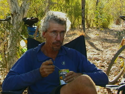
Jim

August 7, 2001

Storing Water - the Early Pioneers

Excavated earth tanks (dams) were first made in the mid. 19th century. This excavated earth tank that we are camping by would have been created around 30 to 40 years ago, for cattle farming. They were made to take the place of wells, which were not as efficient, opposed to an excavated earth tank. One reason that the tank is more efficient is that it doesn’t require humans to fill it. During the wet season the tank fills and holds sufficient water to last until the following wet. This is the reason why the mass of water is called a tank.

dam_dirt_and_treeline2.jpg

This tank is essential to farmers who have large amounts of cattle; one mass of water would not be enough for some 30000 cattle. A farm like Wrotham Park would have to have at least 40 different watering points; around 20 of these would be excavated earth tanks.

Tanks affect the ecology of the land for good and for bad. Many animals don’t have to travel as far to get water, for example kangaroos and black cockatoos; because of this the animals reproduce much more and can become a pest in some areas. Though this may be a problem, tanks don’t take 100% or even 90% of the river, it takes approximately 2% of the tributary and can supply a small herd of cattle drinking water all year.

Feed your children wheat. Joshua

August 5, 2001

A Railway Constructed by Hand

Imagine being handed a pick and a shovel, a section of jungle and mountainous terrain, and being told to build a railroad. The year is 1886, the location, Cairns, and the first shovel full of dirt to begin this engineering feat is overturned by the Premier of Queensland, Sir Samuel Griffith. Construction of the Cairns-Kuranda Railway had begun!

old_rail_line.jpg

Why the need for a railroad? Miners in the Atherton Tablelands were desperate for supplies and were on the verge of starvation. The boggy road leading inland from Port Douglas was impossible to travel in the Wet season and angry settlers voiced strong opinions as to the need for a railroad.

This job would require strategy, fortitude, hand tools, dynamite, buckets and bare hands. Great escarpments were removed from the mountains above the line. Loose rock and overhanging trees had to be removed by hand. Slopes could average forty-five degrees and the entire surface was covered with layers of disjointed rock, rotting trees and loose soil. At conclusion, the deep cuttings and extensive embankments that were removed totaled a volume of over 2.3 million cubic metres of earth.

Out of poor and dangerous working conditions, the Victorian Labour League was formed to improve relations between the railroad navvies and the contractors. Due to the magnitude of the job, relationships between both remained harmonious to complete the task before them.

In celebration of the completion of the early sections to Kuranda, a banquet was prepared for a visit to the site by the Governor of Queensland, Sir Henry Norman. The full banquet was served atop the Stoney Creek Bridge, swaying dizzily at a spectacular height above the gorge. Speeches for the occasion were suspended due to the roar from the waterfalls below!

Within a month, the Cairns-Kuranda Railway line was opened to passenger travel. Future sections constructed to the west created a reliable supply of goods and freight to the early settlers. The Tablelands blossomed into a wealth of rich grazing lands to the west and beyond.

Suggested learning activity: investigate an engineering feat (e.g. a road/railway/bridge) local to you and find out its history: how it was constructed, by whom and for what purpose. What tools and technology did they have available to them and compare how things might be different if they were to build the same feature today?

April

August 1, 2001

Short Rations

The year is 1873. You are about to set off for the Palmer River gold fields, the distance from Cooktown to the start of your adventure is a week’s walk. What supplies would you take to last you several months away from any supply centres? What would be the most important item you’d gladly pack?

Murdo Cameron was a seasoned veteran of the early gold rushes. He had pushed upriver about thirty five miles and, as it was a Sunday evening, he found a promising spot, unpacked his horses and prepared to make camp for the evening. He wandered to the river to fill his billy for evening tea when something caught his eye. Glittering among the river rocks was gold. Cameron panned four ounces in his first attempt! As there wasn’t another man for miles, he lit his fire, made a billy of tea and ate the last of his damper. Cameron was about to start the rush…

For all of the hardships of the early miners, short rations of food played the biggest role. Of the necessary ingredients to have on hand, flour was the most important and damper was the staff of life. In Cooktown, a three pound bag cost three pounds. On the Palmer River, it would start at around twenty pounds per bag.

palmer_goldfields_sign.jpg

Purchasing flour in the gold fields was by no easy means. William J. Webb wrote, “ Mrs. Neil stood on the dray cart and conducted the sale of flour at half a crown a pound. If the lady didn’t like the looks of you, or found fault with your manners, or thought she could read in your eye any question as to whether the battered pannikin she measured with really held a pound of flour, you went without and that was all about it.”

As the Wet season approached, miners stayed in the gold fields until the last possible moment before heading back to the coast. Unlucky was he that didn’t have a ration of flour to start the journey. Webb reported short rations on the track, which reduced those in his party to eating ‘bango’, boiled flour and sugar. As conditions became more difficult, many would gladly trade their hard earned gold dust for a pound of flour to see them through.

April

July 26, 2001

Old Laura Homestead

Early homesteaders in the Cape York Peninsula faced many challenges. Cattle stations, originally established to provide beef for the Palmer River gold miners, became self sufficient outposts on the frontier.

Fergus O’Beirne purchased the land for the original Laura homestead in 1879. Even though the gold rush began to decline about 1880, the fledgling cattle industry was beginning to hit its stride. By 1894, the Laura Homestead was running approximately 8000 head of cattle.

laura_homestead.jpg

The isolation of the cattle stations was only one of the difficulties faced by the early settlers. When supplies were needed, station owners could expect a two to three day ride to the nearest supply center. However, during the Wet season, roads and rivers became impassable.

Due to these types of conditions, it became necessary for cattle stations to become their own supply centers. Homesteaders would grow their own crops, including vegetable gardens. A blacksmith shop was able to make repairs on wagons, plus keeping shoes on the horses needed to gather the cattle. Beef could be processed on the homestead to feed the many Aboriginal workers hired as stockmen.

By the 1960s, the old Laura Homestead had deteriorated. After renovation efforts, the outbuildings which stand today, serve as a tribute to the hardy pioneers of the Cape York Peninsula.

April

July 25, 2001

Battle Camp

We crossed the ford of the Normanby River, its clear, quiet waters portrayed a peaceful place. However, in the 1870s during the Palmer River gold rush, meetings between the miners and the local Aboriginal people in the area were anything but peaceful.

On 3 November, 1873, a group of miners camped above the ford. With the arrival of some local Aboriginals, twenty five of the miners’ horses disappeared After retrieving the horses, the Aboriginals approached the miners, giving the illusion of wanting to ‘parley’ or talk. Some miners reported at the time, that the meeting seemed peaceful, however, it deteriorated rapidly as the command was given to mounted riders to charge into the middle of the visitors. Grabbing their spears, the Aboriginals ran into the bush.

battle_camp_sign.jpg

The miners moved south, unaware that approximately 500 Aboriginals were following them. While watering at the river, fresh footprints were discovered rapidly filling with water. This indicated to the miners that the camp was being observed and guards were put in place.

Early on the morning of 5 November, the Aboriginals were sighted, surrounding the miners’ camp. A pitched battle began, with the Aboriginals quite overpowered by the miners’ guns against their spears. Apparently unaware of the effectiveness of gunpowder over their primitive weapons, the Aboriginals suffered devastating losses. This is recorded as the only battle fought between the Aboriginals and the miners in which the Aboriginals formed ranks and charged in an organized formation. Future encounters would be conducted relentlessly in ambush and sneak attacks.

April

July 24, 2001

Cape York - Early Settler and Visitors

The Aboriginal people of the Cape York peninsula, Kie Daudai, have lived here for 30,000 years. Traces of their existence are evident in the markings left behind, such as the deep engravings in the sandstone rock. Bird tracks, concentric circles and lines record shapes of ancient histories.

Evidence of ancient practices are still in use today. Controlled burning as a land management tool has been in use prior to colonization. As the expedition team moved south from the mouth of the Starcke River toward Starcke Station, blackened sections of forest and undergrowth indicated present land management practices continue in the bush. After a bush fire, 6000 year old Xanthorrhoea grass trees remain as if to stand guard over the ancient land. Fire continues to be the seasonal tool used to flush out wild game and to promote the regrowth of natural vegetation.

As Captain Cook’s Endeavor sailed up the east coast of Australia during the 1770s, he noted smoke rising from the nearby hills. This provided evidence that Aboriginal people practiced these controlled burns, starting the fires with a pointed firestick twirled into a flat piece of dry softwood. Although today’s burning practices are conducted by more modern techniques, the burns, as in ancient times, still provide a useful tool in managing the environment.

April