THEME: Cattle Ranching
SUBJECT AREA: Education for Sustainable Development (ESD)
TOPIC: sustainable farming practises
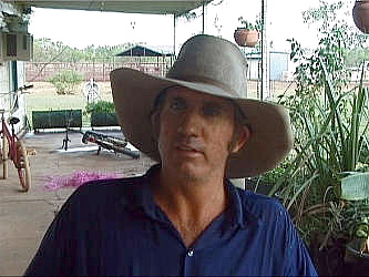
During our stay at Moolooloo Station we got to interview the Station Manager Mark Clifford. One of the questions we asked him was how important it was to protect the land from overgrazing or soil erosion from the presence of cattle. This was his answer:
“Well it’s critical and is a fairly large part of our job. As a company we use things like satellite imagery. There’s a Northern Territory range management body that actually comes out here and monitors certain sites on an annual basis to make sure there’s no pasture degradation. Obviously we also keep a close eye on the paddocks. There’s a scientist within the company who does a lot of work looking after the pastures. They also run trials to help us understand what we can do with the country without causing degradation.”
The reason cattle ranching in the Victoria River basin has been so successful since Nat Buchanan first stocked nearby station Victoria River Downs in 1884 (see History update for the day) is largely because of the protein rich grasses that thrive on the black clay soil and the amount of rainfall the area receives each year (around 28-30 inches per annum). But, during drought years, when the reduction of vegetation in turn means the soil is more open to erosion from the wind, the land is in serious danger of becoming degraded. Should a particularly dry winter (April through October) be followed directly by a particularly wet summer (November through March), the topsoil will be further eroded by floodwater. Add cattle to the equation, especially more than the optimum cow/calf unit per square kilometre, and you could be in trouble. Mark continues:
“It’s not impossible to have a drought year, in which instance we have to look quite closely at our cow/calf unit per square kilometre – normally around 6 to 1 on Moolooloo. In drought years we’d have to look at reducing this figure to maybe 3 or 4, or even less, and taking the surplus animals off the land.”
Suggested learning activities: it seems that monitoring the pastures, either by satellite imagery from space or by a scientist on the ground, is the method that Mark uses to safeguard his pastures from degradation. Data from monitoring procedures can be used in conjunction with computers to build ‘models’ from which he can make well-timed range management decisions, such as an early reduction of the cow/calf unit per kilometre ration - before it gets too late and erosion sets in.
Suggested learning activities: Find out about another farming practice – perhaps in the area near where you live – in which monitoring the effect of the farming upon the land forms an essential part of land management and how the environment is safeguarded from undue degradation. If the farming practise involves animals, compare the carrying capacity of the land (animal to square kilometre ratio) to that of Moolooloo station. If the figures are very different, suggest reasons as to why this is the case?