Just off the Ross Highway, some kilometres northeast of the Emily and Jessie Gaps, is a weathered, rippled rock called Corroboree. It began to be formed some 800 million years ago when a shallow, salty sea laid down a fine silt. Algae grew over this silt and shaped itself into mounds that solidified into rock over millions of years.
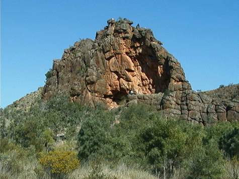
The movement of the earth caused the folding of strata (layers) of rock into the vertical plane, causing the original horizontal layers to stick straight up out of the earth in the form of a ridge. Wind, rain and sun gradually wore down the ridge, with only Corroboree, a particularly hard section of rock, remaining today.
The three predominant colours in the rock are black, orange, and white. The black colour comes from the oxidation of iron particles within the stone, and the orange and yellow are the result of tropical weather conditions.
Suggested learning activities: Identify an example of weathering of a geological feature in your local area. Compare and contrast the weathering forces (sun/rain/wind etc) to those operating on Corroboree.
Git