« Overland Australia - Update 26 | Main | Overland Australia - Update 28 »
August 22, 2001
Overland Australia - Update 27
2001 August 2, Wednesday. North Urandangi Road.
The earth around the large dam appeared dry and hard; the early
afternoon sun heated the already cracked surface. We approached to
check the clarity of the water - it was time to camp, and as water becomes
more and more scarce, we look for bores and dams with water suitable
for rinsing dishes and wiping tables. This preserves our fresh water for
drinking and cooking. We had passed a good many dams throughout the
day, though none so big and lake-like as this one. Leaping from the upper
bank of the dam, I landed near enough to the edge not only to see that
the water was murky, but also to sink knee deep into deceptively soft
mud.
In the last few days, I've come to appreciate god - it's called fresh
clean running water; and there's no such thing within Mount Isa.
Absolutely the most repugnantly nauseating piped water I have yet
experienced is to be found there. As Mount Isa water was in my Camelbak
and water bottles, I was searching desperately for an alternate source.
While the long-toiling team sweated out the unpacking of the truck at
the camp site which had been chosen a little way up the road (away from
the useless dam), I traipsed across country on my own little expedition
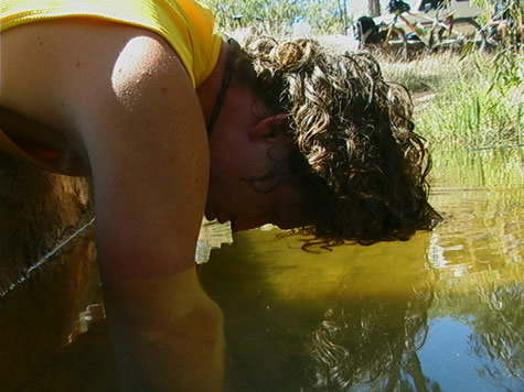
to find half decent water. After a few dead leads, I discovered a hose
running clear, warm water direct from the earth into a tank fenced off
from stock: priceless. I arrived later at a fully set up camp, all
clean, with washed hair and clothes, just in time for the meeting.
Hopefully I made up for my cop-out of camp setup by volunteering to
write this update.
Something of a surprising coincidence to find such a perfect water
source out here by chance? Not really. While most bore water is
savourless, supply is not as infrequent as might be guessed from a
scrutiny of the landscape. The Eromanga basin, the central and largest
section of the Great Artesian Basin, is below us, and is tapped by
station owners here as the only source of water during the dry season,
and the most reliable at other times of the year. The availability of
this underground water makes settlement of the interior of the
continent possible.
The Great Artesian Basin lies in the centre of Queensland, under one
fifth of the entire country, and beneath an area inhabited by 200 000
people. It is filled mainly by rainwater falling on the Great Dividing
Range, where it seeps into the earth, and travels slowly west across
the border of the Northern Territory. Some of the water is thought to have
been in basin aquifers for over two million years.\
The clear water in this particular bore was so agreeable that I
returned later, with emptied water bottles and Camelbak bladder, to replace all
of the Mount Isa water in my possession with the piped water. Meanwhile,
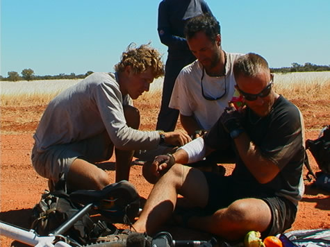
a group set to work cleaning and re-dressing Mike's wounds. Mike, during
the regular pick-pocketing game of "who took my apple, and who has my
hat?" had taken an epic stack after a collision with Jason, and landed
hard on the gravel road. Although he was able to continue riding for
the fifteen or so kilometres in to camp; he was one apple and one orange
poorer - they had broken his fall, saving his hip while making a lovely
mess in his pocket. Now we are sitting around our campfire chatting, with Crister playing the blues on guitar; all waiting for the red ants - in the midst of
whose territory we have set up camp - to go to bed and give us some
peace.
bel
CLASSROOM ACTIVITIES >>
Education for Sustainable Development (ESD)
Science
Geography
Maths
Posted on August 22, 2001 10:26 AM